OnBux

Wednesday, September 22, 2010

Dominican Republic Adventures

Best time to go

Despite its year-round hot summer temperatures, the Dominican Republic’s tropical climate and location makes it prone to hurricanes and torrential rain. Hurricane season runs from June to November, while the rainy season on the north coast runs from October to April and May to November on the south coast. The busiest time of year is between December and April when North Americans take their vacations to tropical climes. The European tourist stampede is generally June to September.

Travel in the Dominican Republic offers a chance to experience the Caribbean off the beaten track. It is home to some of the Caribbean’s best and least crowded beaches and the sounds of the merengue is never far away. If you are lucky enough to travel the Dominican Republic during a carnival, you’ll be in for a real party!

Top tourist attractions in Dominican Republic include:

* Cabritos Island center located in Lago Enriquillo and features crocodiles, flamingos, white crown pigeons and much more.

* The Dominican Republic Jazz Festival which is held at Cabarete every year during the first week of November. The festival brings jazz musicians and bands to perform on the beach.

* The Santo Domingo Merengue Festival, which is a weeklong event hosted at the Malecon during the last week of July.

* Whale watching in Samana Peninsula where you can see humpback whales.

* The Three Eyes of Water (Los Tres Ojos De Agua) cave which is located four miles from Santo Domingo and features tropical greens and an underground crystal clear river.

* Exploring San Cristobal City where you can learn more about Dominican Republic culture.


 * The Manati theme Park where you can see exotic animals such as iguanas, flamingos, etc; and swim with dolphins and sea lions.

* The Azua de Compostela city which features an impressive church, an Archeological Museum and a city hall and market.

* Pueblo Viejo where you can explore ancient ruins and historical structures.

* The Mount Isabel de Torres which offers scenic views of the Atlantic Ocean.


* The Day of the Dead festival which happens at the beginning of November and it is a celebration where the locals honor the dead.


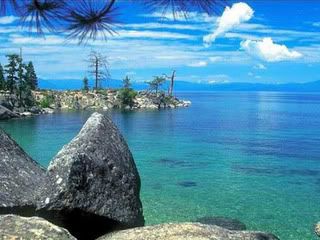
* The Samana Peninsula which is located north of the island and features blue water sandy beaches as well as beautiful caves.
 

Check it Out

Tuesday, September 14, 2010

Papua New Guinea lost Paradise


Searching on the net I found this lost Paradise

Check this out!!!

Old initiation ceremonies

The boys from the Sandaun province also went to live in the “Haus Boy” when they reached a certain age. While there, they were taught skills of hunting, fishing, gardening, and also magic and rituals. These were also practiced in Gulf and in East New Britain.

Initiation was also an important ceremony in those days. The ceremony allowed people to recognize that the boy had reached his manhood. The purpose was to teach the youth to live a better life, respect his elders and the traditional values in order to have a good status in the society.

Each province had different initiation ceremonies, the male initiation was called Warkinim and the Tumbuan initiation was called Awarpakat.

In Tufi, Northern province, young Korafe men were not allowed to shave or look in the mirror in front of their uncles until their mother’s brothers had initiated them.

The young men of Sundaun were also not offered by young girls until their uncles and kanderes had carried out their initiation ceremonies.

In the North Solomons Province when a boy showed signs of maturity, village elders organized a ceremony where the boy was taken into the jungle to carry out several test that would prepare him for life.


APSense RevPage

This ritual involved eating special kinds of food. Sacred information of rules were passed to the boy during this ritual. This taught him to be a responsible person and to respect women and village elders.
  Some Cash?

Monday, September 13, 2010

Planet Earth TV Series


Planet Earth is a 2006 television series produced by the BBC Natural History Unit – not to be confused with the 1986 PBS television series of the same name, narrated by David Attenborough. Five years in the making, it was the most expensive nature documentary series ever commissioned by the BBC, and also the first to be filmed in high definition.[1] The series was co-produced by the Discovery Channel and NHK in association with CBC, and was described by its makers as "the definitive look at the diversity of our planet".


APSense RevPage' target='_blank'>build your massive income
Planet Earth was first broadcast in the United Kingdom on BBC One in March 2006, and premiered one year later in the USA on the Discovery Channel. By June 2007, it had been shown in 130 countries worldwide.[2] The original BBC version was narrated by David Attenborough and produced by Alastair Fothergill. For Discovery, the executive producer was Maureen Lemire, with Sigourney Weaver's voiceover replacing Attenborough.
The series comprises eleven episodes, each of which features a global overview of a different habitat on Earth. At the end of each fifty-minute episode, a ten-minute featurette takes a behind-the-scenes look at the challenges of filming the series.


More than five years in the making, PLANET EARTH redefines blue-chip natural history filmmaking and continues the Discovery Channel mission to provide the highest quality programming in the world. The 11-part series will amaze viewers with never-before-seen animal behaviors, startling views of locations captured by cameras for the first time, and unprecedented high-definition production techniques. Award-winning actress and conservationist Sigourney Weaver is the series' narrator.

Sunday, September 12, 2010

Victoria Falls - Zambia


Described by the Kololo tribe living in the area in the 1800’s as ‘Mosi-oa-Tunya’ - ‘the Smoke that Thunders’ and in more modern terms as ‘the greatest known curtain of falling water’, Victoria Falls are a spectacular sight of awe-inspiring beauty and grandeur on the Zambezi River, bordering Zambia and Zimbabwe.

Columns of spray can be seen from miles away as 546 million cubic meters of water per minute plummet over the edge (at the height of the flood season) over a width of nearly two kilometers into a deep gorge over 100 meters below. The wide basalt cliff, over which the falls thunder, transforms the Zambezi from a wide placid river to a ferocious torrent cutting through a series of dramatic gorges.

Facing the Falls is another sheer wall of basalt, rising to the same height and capped by mist-soaked rain forest. A path along the edge of the forest provides the visitor who is prepared to brave the tremendous spray with an unparalleled series of views of the Falls.

One special vantage point is across the Knife edge bridge, where visitors can have the finest view of the Eastern Cataract and the Main Falls as well as the Boiling Pot where the river turns and heads down the Batoka Gorge. Other vantage points include the Falls bridge and the Lookout Tree which commands a panoramic view across the Main Falls.

"The first impression was unmistakable; immense power, the raw energy unleashed when the entire Zambezi leaps wildly into a black two kilometer wide abyss. The scale is massive, the spectacle spellbinding and perpetually changing. The falls hiss and roar as if possessed, they rumble and crash like thunder. Vast clouds spew and billow out from the seething cauldron of its dark impenetrable depths. The moving water creates a magnetism that sucks you closer, so that you recoil in horror to quench a subliminal sacrificial urge." (Jumbo Williams, Zambezi, River of Africa. 1988)


Click Here